by Tim Willmott : Comments Off on Climate Change and Caribbean Sea Level Rise
It’s a depressingly common event: a report about the devastating impact climate change will have on islands and coastal regions. Alongside the Maldives, Vanuatu and others, is a report from Caribsave (with NGO partners) about the effects of climate change in the Caribbean Sea.
Their conclusions:
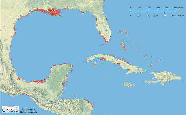
- SLR (sea level rise) by the end of the 21st Century could reach as much as 1.5m to 2m above present levels. With its proximity to the equator and related gravitational and geophysical factors, SLR will be relatively more pronounced in the Caribbean than some other coastal areas of the world.
- The impacts of SLR will not be uniform among the CARICOM nations, with some projected to experience severe impacts from even a 1m SLR. Based on available information, The Bahamas, Suriname, Guyana, Trinidad and Tobago, and Belize are anticipated to suffer the greatest economic losses and damages in absolute economic terms, while the proportional economic impacts (losses compared to the size of the national economy) are generally higher in the smaller economies of St. Kitts and Nevis, Antigua and Barbuda, Barbados, St. Vincent and The Grenadines and Grenada.
- In nations where low lying-land is extensive and is therefore more exposed to the impacts of SLR and storm surge, concerns are damage to agriculture, industry and infrastructure as well as salt water intrusion into groundwater reservoirs.
- For nations with a more complex topography characterised by steeply sloped coasts fronted by only a narrow strip of low lying land, the main concerns are landslides, beach erosion and disruption to infrastructure that is concentrated in limited flat land areas.
- Nearly one-third of major tourism resorts and airports are at risk to 1m SLR. A large majority of land around seaports, which are so vital to island economies, are also vulnerable to flooding from 1m SLR.
- Extreme storm events that the Caribbean is subjected to annually assume greater prominence. A storm surge of this magnitude would see serious impacts to key infrastructure, such as airports (100% of airports at risk to damage in Antigua and Barbuda, Belize, Dominica, Grenada, St. Lucia, and St. Vincent and Grenadines) and tourism resorts (over 50% of resorts at risk in Antigua and Barbuda, Belize, Haiti, St. Kitts and Nevis, St. Vincent and Grenadines, and The Bahamas) because of their proximity to the coast.
- Erosion associated with a 2m SLR would result in 60% of the region’s coastal resorts being at risk. Importantly, the beach assets so critical to tourism would be affected much earlier than the erosion damages to tourism infrastructure, affecting property values and the competitiveness of many destinations.
- The costs of coastal protection schemes are highly likely to exceed the capabilities of the small island nations and coastal nations of CARICOM.
- Continued development of vulnerable coastal areas will put additional assets and people at risk and raise both damage as well as protection costs. Protection of cities could offset the substantial damages in urban areas, but as noted, this adaptation strategy comes at a substantial cost that is expected to be beyond the Financial capacity of CARICOM governments.
- Consequently, there can be no other conclusion than that projected SLR would be nothing short of transformational to the economies of CARICOM nations. The costs of losses and damages resulting from unprotected coastlines and the costs of protecting high-value urban coastlines and strategic infrastructure will have a major impact on individual communities and national economies. Without significant support from the international community, the resource allocations needed for coastal protection alone severely impedes the pursuit of sustainable development.
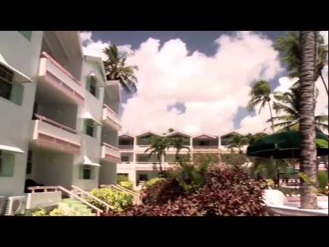
Christ Church, Barbados
loading map - please wait...

Related articles


Article by Tim Willmott
Tim is the creator of sustainapedia.com and heads digital publisher Treading Lightly. His interests include nature and wild places, cooking, film, sport and music. He is a poet, writer and commentator.
Comments are closed